Thar has a unique topography – beautiful in sight and charming to mind. Its sandy area has a vast stretch and the sand dunes are spread over it as lines on the palm of nature.
By Noor Ahmed Janjhi
Thar has a unique topography – beautiful in sight and charming to mind. Its sandy area has a vast stretch and the sand dunes are spread over it as lines on the palm of nature. The alluvial fertile exposure of topography offers a different look. The rocky terrains of Karoonjhar range reflect a beautiful view as the nature has riveted it beautifully. Marshy land of Rinn Kachh offers a unique topography. In this way, Thar is a very unique phenomenon of nature. Its topography is a diversified phenomenon. The sandy area, the alluvial tract, the hilly exposure and the marshy strip make the area not only beautiful but diversified and resilient. The diversity and resilience are expressed in shape of simplicity. Let us discus all of the features of the outlook of Thar.
 Sandy area or Thar
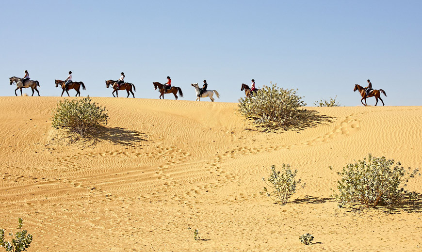
Sandy area generally called Thar is a vast part of Thar. It is a sandy tract stretched over more than eighty percent of the area. It has vast sandy tracts and sand dunes. All of the dunes pose a unique look. They start from east and end in the west. The dunes are just arrows of the compass guiding to travelers in the desert. They look very much beautiful when there is greenery after monsoon rains. The lush green look of these sand dunes attracts the livestock and a variety of wildlife species. The dunes are called Bhitoon in Sindhi. Smaller sand dunes are called ‘darra’ in Sindhi and ‘dhora’ in Dhatki. There is a wide range of terms associated with these sand dunes. The starting point of the dune is emerged high and called ‘gaat’ and ‘mathari’ and ‘gatri’. At the foot of the ‘gaat’ or ‘gaatri’ there is called ‘bukirr’.Its declining end is called ‘pochando’ and if it is bifurcated in two, it is called ‘phanghue’. A small prong emanated from the dune at the end is called ‘muchh’. The side of the dune exposed to sunlight is called ‘tirrkol’ and the other side is called ‘gochhar’. If a dune emerges at its middle, then it is called ‘oochah’ or ‘oochaho’. If the emerging point is located at any other place than the middle point, it is called ‘tonk’. Small paths on the dunes are called ‘pajoon’. A wider paj is called ‘wadho’. These paths give also way to rainwater to flow towards low lying depressions. All the dunes are known with particular names ranging from a historical name to the names reflecting the topographical profile.
Besides the dunes, the other tracts of sandy exposure are flat, declining and sandy ridges. The flat vast sandy tracts are called ‘dahar’ and contain mixed alluvial and sandy profile. The dahars are also known with the particular names as ‘hekal kori’ , ‘chhachhi’, ‘mennchho’, ‘daki’ , ‘gauchar’ etc. small dahars are called ‘chhotiyo’. These dahars are very much fertile because of its mixed profile and even absorption of rainwater. The declining small patches called ‘dago’ contain soft sand sandy ridges are called ‘dararr’. The land of dago is utilized for cultivation but the dararr are left barren for grazing purpose.
The alluvial tract between two sand dunes is called ‘dahri’. The entire valley is called ‘marrho’ if it is vast and the narrow valley is called ‘noann’. A smallest tract between two small dunes is called ‘mandar’.
The dunes have been the ideal places for village settlements. During Rajput period, most of the villages were established there at the dunes because of environmental considerations and defence point of view.
 The Alluvial Thar
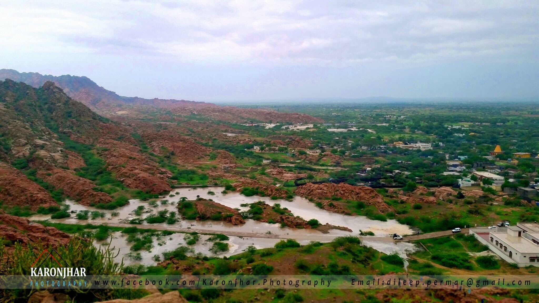
The strip called Parkar , is alluvial and fertile. It has rainwater lakes and the rain streams emerging from Karoonjhar hills making deltaic profile. The Sangah Lake is a famous lake of Parkar. Besides the alluvial tract of Parkar, there are some alluvial pieces of land in sandy area. The alluvial piece at the center of ‘noann’ called ‘tali’ is a fertile piece of land. During the land settlement of 1935, only the ‘talis’ were declared arable. The remaining portion was left for livestock and rainwater catchment area for ‘tali’. The rainwater depressions called ‘tarai’, ‘tobho’ and ‘daho’ contain alluvial posture as slit is deposited there since long.
 The Hilly Area
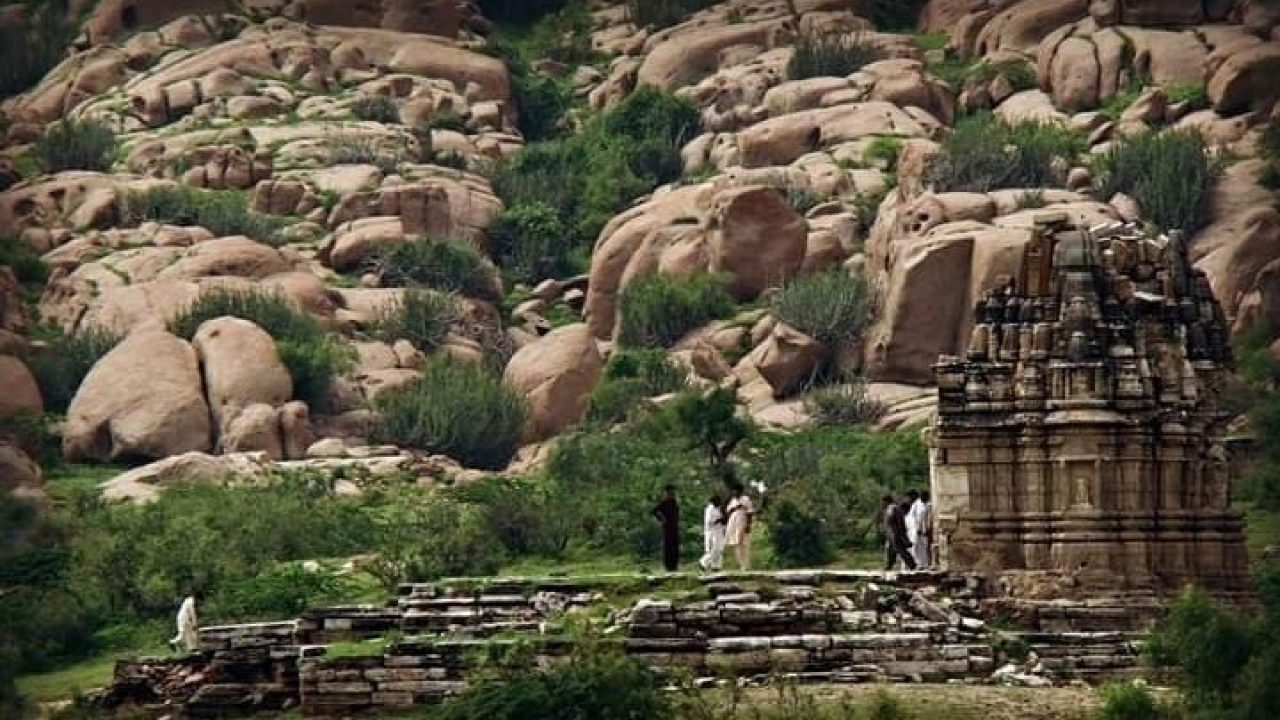
The land of Parkar is riveted with the Karoonjhar Hills. A wide range of different elevations can be seen in the south east of Parkar. All the rocks have different names and are known by a robust name of Karoonjhar (a mountain with black dot). The hilly profile is a rich topographical trait of the area offering a great flow of rainwater, and wide range of flora and fauna. Some sixteen rain streams spring out from the mountain and irrigate the alluvial tracts of Parkar. Some of them are Bhatiyani, Gordhro, Dhoopa, Ghariyari etc. Some perennial reservoirs are in the mountain too. Mirghi Kun and Anchlas are worth mentioning in this regard. Although the mountain range does not occupy vast area yet it is a beautiful, mysterious point attracting many more.
The Marshy Land
It is a small strip ranging from the southern part of Diplo taluka to the Hilly tract of Parkar. It is a natural crescent of the marshy exposure embracing sandy area and hilly terrain. Somewhere it has penetrated and has made inland tracts too. There are salt mines of good quality salt in Diplo and Nagarparkar. The marshy land tract is very rich in biodiversity, flora and some species of wildlife.
This is major topographical posture of Thar. However, its areas are attributed with particular names of socioenvironmental zones as Mohrano, Wango, Watt, Kassue, Kantho, Paair, Onher, Dhaat and Khaaurr. Thar is its general name for the entire area. The district is named as Tharparkar, an assimilation of two words ‘Thar’ and ‘Parkar’. People of Khaaurr and Dhaat call it Tharri also. The word Tharri is used a synonym for a sand dune.
 The topographical profile of Thar reflects it as the land of sea resulted as Thar in a great geological process or tsunami. The tsunami recessed the sea and topographical schism emerged in shape of the dunes by winds blowing as the time passed by. The smooth stones and rocks of Karoonjhar and the mixed vegetation in Thar show the signs of the availability of water – brackish as well as sweet water. The topography of Thar has a diversified profile reflecting the signs of marine profile, estuaries, and rivers.
_____________________-
About the Author
 Noor Ahmed Janjhi is a senior educationist based in Desert District Tharparkar Sindh. He is author of several books in Sindhi and English on folk literature including two poetry books.