From Minor Village to World Metropolis: Karachi in Maps
The transformation of Karachi from a small village into one of the world’s major commercial hubs is an amazing story

Karachi or Kolachi was established in 1729 by the Talpur, a Sindhi-speaking tribe
By Ryan Moore
The former capital of Pakistan, Karachi is the most populous city in the country and the third most populous in the world. Before it was Karachi, the place was called Kolachi, a small village on the Arabian Sea. Kolachi was the surname of the founding fisher-woman, Lady Kolachi, according to local lore. The transformation from a small village into one of the world’s major commercial hubs is an amazing story. This blog post explores some of the maps that illustrate Karachi’s titanic growth.
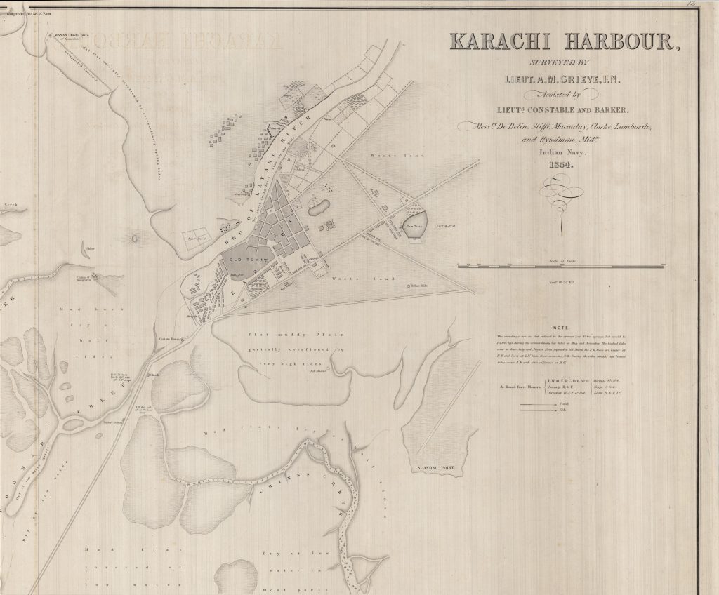
Kolachi was established in 1729 by the Talpur, a Sindhi-speaking tribe. In 1800, the village caught the attention of the British East India Company, which received permission from local authorities to build a factory. The British East India Company seized the city in 1838, and it was eventually placed under the control of the British crown. Karachi’s harbor and humble beginnings can be seen in this portion of an 1854 British survey map, which is shown below.
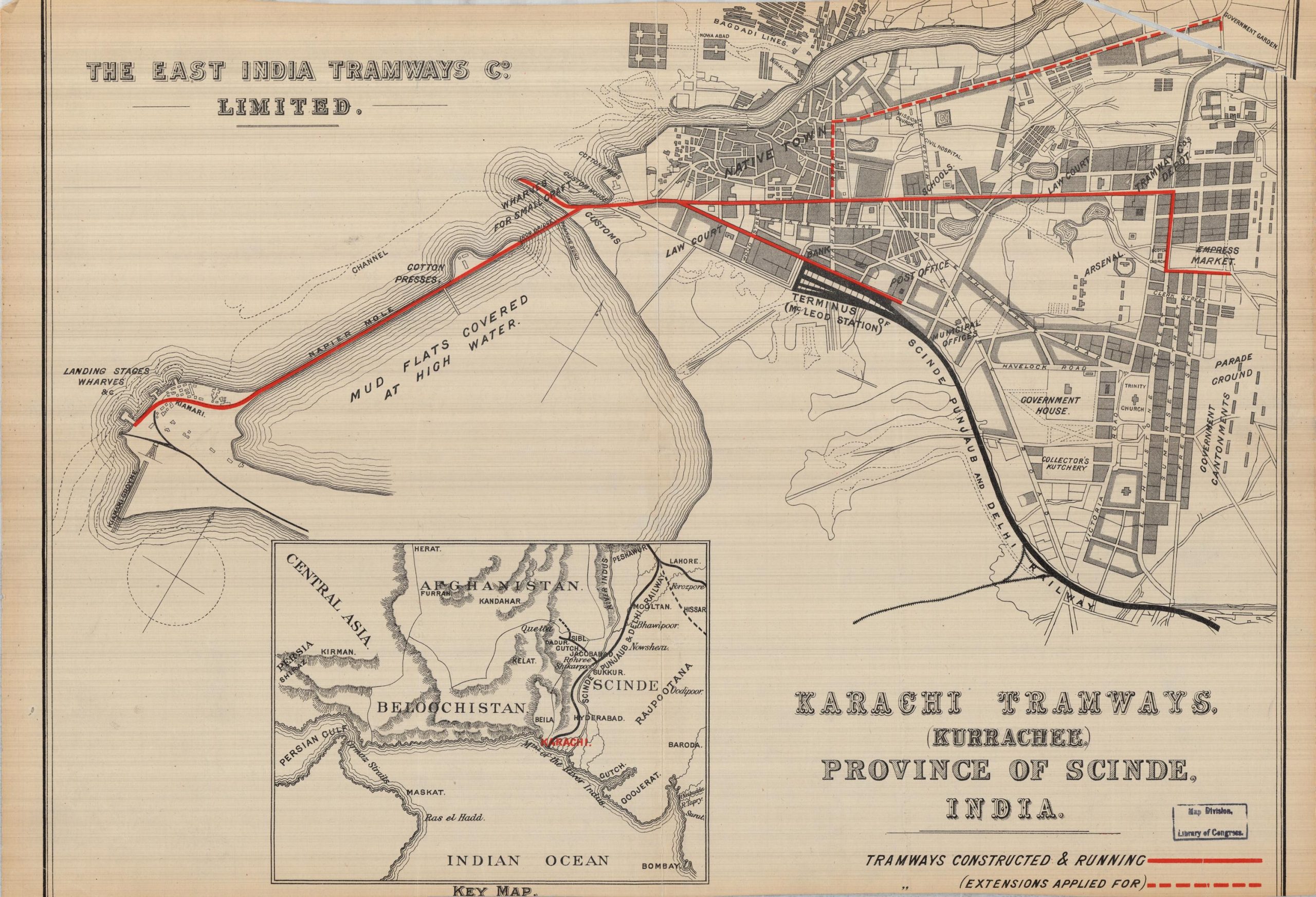
Transportation networks were necessary to help develop the city. The East India Tramways Co. Ltd. formed in 1902 and steadily replaced horse-driven trams with gas-powered engines. By 1912, horse-driven trams were a thing of the past and the new trams had the capacity to carry some 46 passengers at a speed of 18 mph. In the undated map below, Karachi Tramways (Kurrachee) Province of Scinde, India, tramways are shown running from “Empress Market” to the wharves and cotton presses. An additional route passed by the law courts and reached “McLeod Station,” the terminus of the “Scinde, Punjaub, and Delhi Railway.” An extension line was plotted to pass through “Native Town” and intended to end at “Government Garden.”
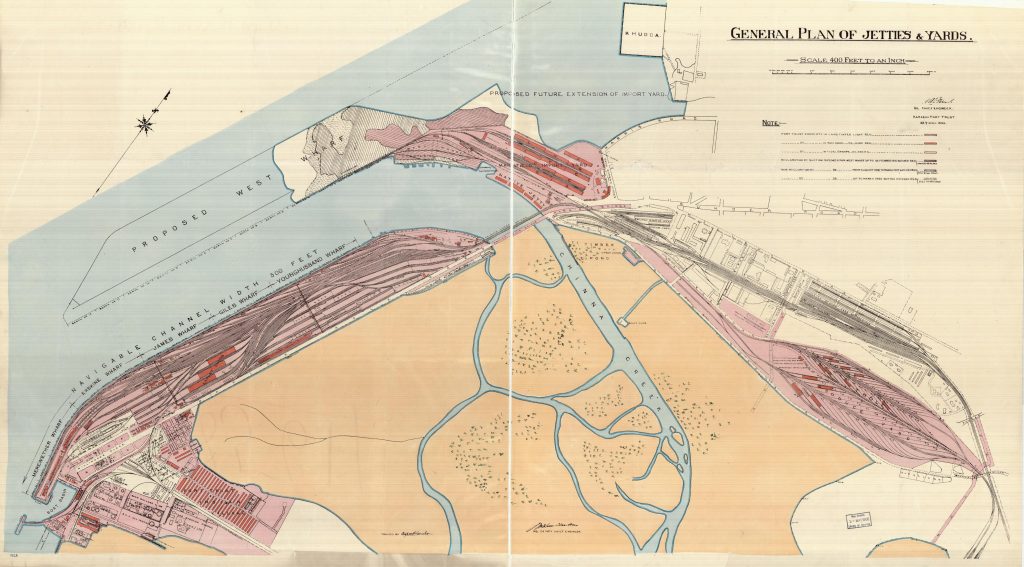
Karachi’s seaport was vital to its economy, but by the early twentieth century, it lacked enough land. In 1920, the Karachi Port Trust published a General Plan of Jetties and Yards, which illustrated plans for expanding the “West Wharf” by means of land reclamation. From 1916 to 1920, land was reclaimed in three stages, which are represented on the map by pink with black backslashes (1916), white with black forward slashes (1919), and white with short, black forward slashes (1920). The amount of the reclaimed land is listed under “Note” on the map below.
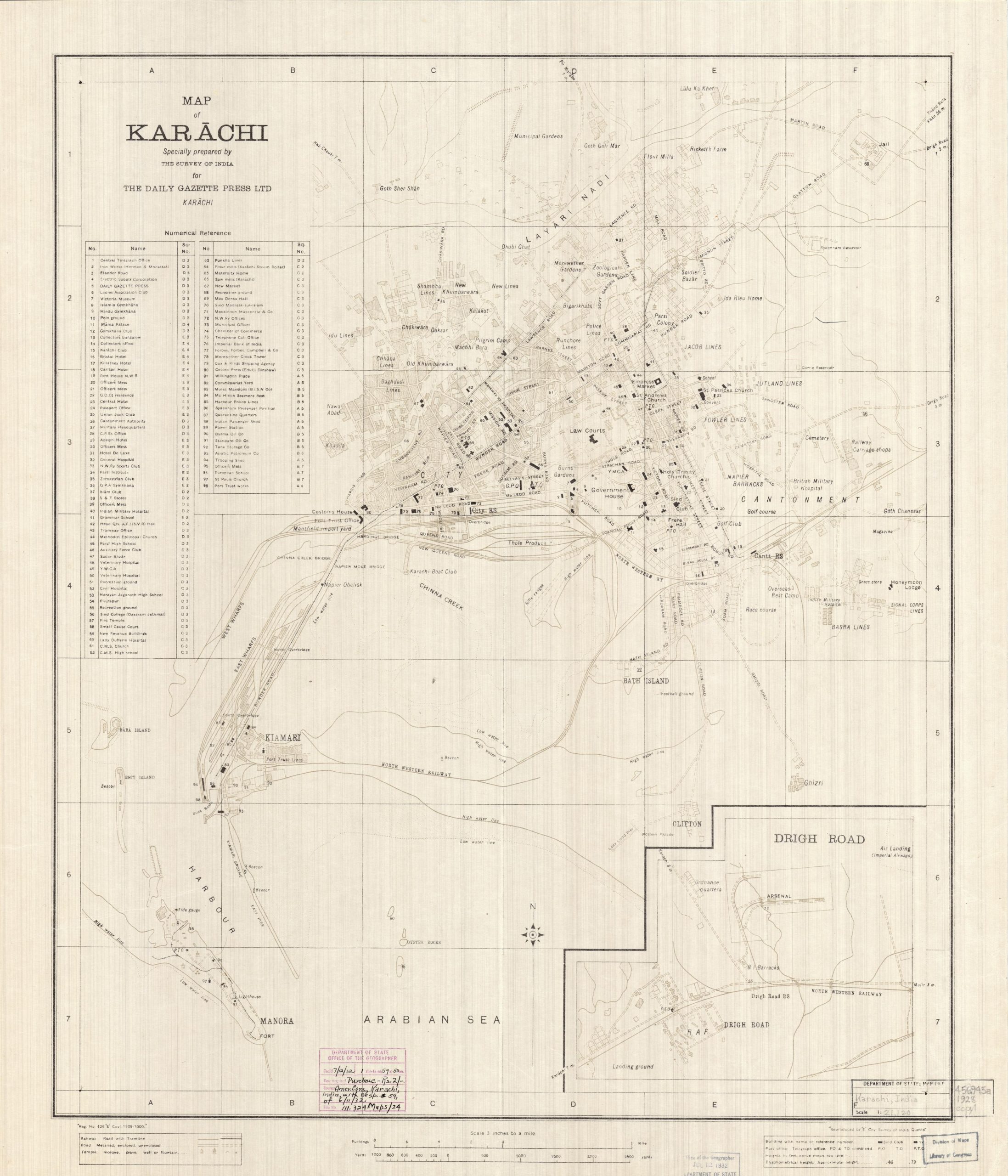
The Survey of India prepared a tourist map of Karachi, seen below, for the Daily Gazette Press Ltd., a newspaper that operated from 1915 to 1938. The map appears to have been published in 1928, according to stamped information by the State Department. The map is scaled at 3 inches to a mile and offers great detail about the locations of government buildings, commercial centers, houses of worship, transportation networks, among others. On the map’s left margin is a list of ninety-eight landmark locations that includes the Carlton Hotel, Y.M.C.A., Burma Oil Co, Islamia Gymkhana, Sadar Bazar, and Sind College. Throughout the map, the presence of many shipping companies serves as a testament to Karachi’s thriving seaport. The insert in the lower right depicts British military facilities, including a Royal Air Force landing ground and base, barracks, ordnance quarters, and an arsenal. The information reminds the viewer of the once colonial status of the city.
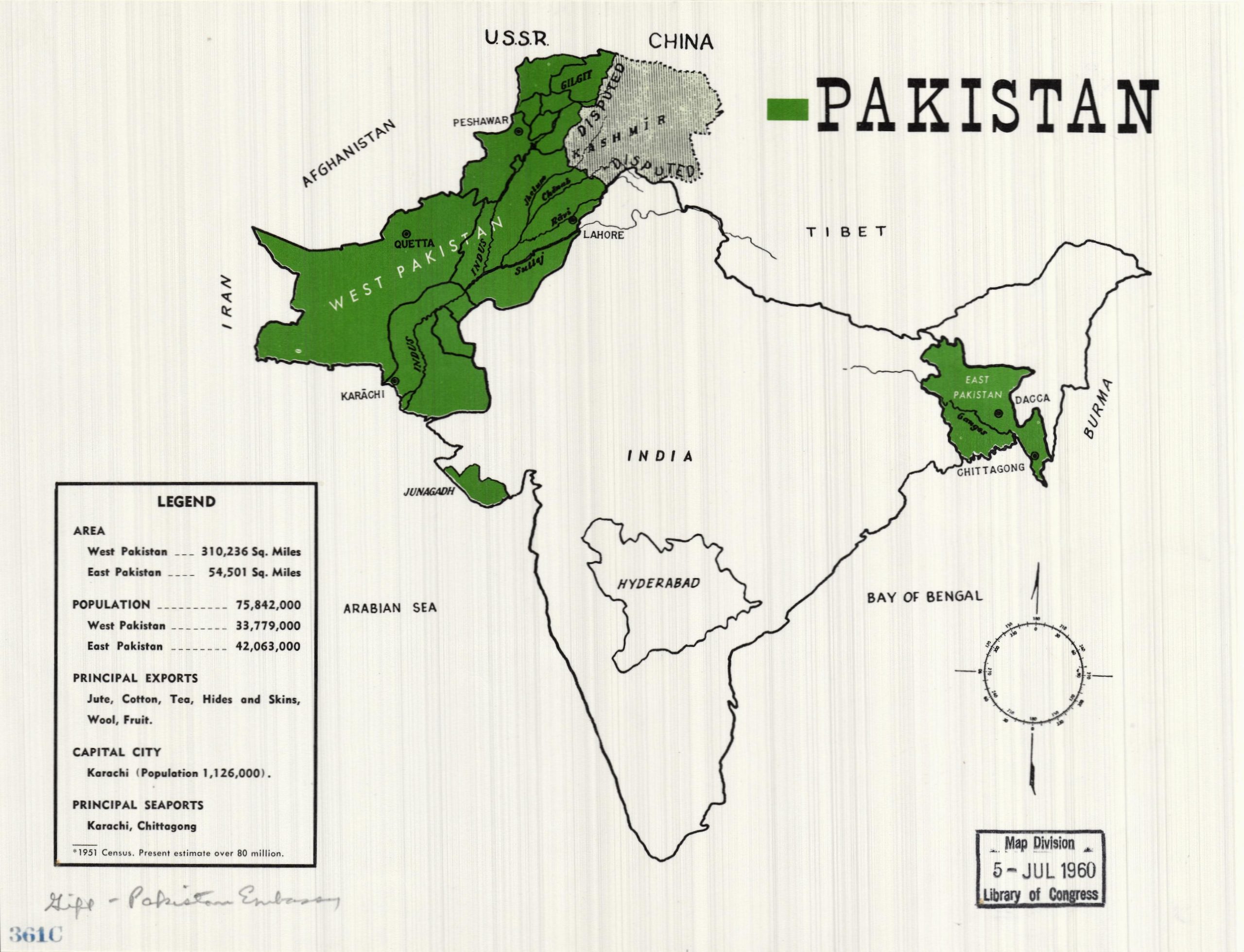
In 1947, British colonial rule ended in India and the region was partitioned into the sovereign states of India and Pakistan. The Embassy of Pakistan donated the political map, shown below, to the Library of Congress. The map is colored in green and white, the colors of Pakistan’s flag, and the legend provides information about the total area of land, population, and principal ports.
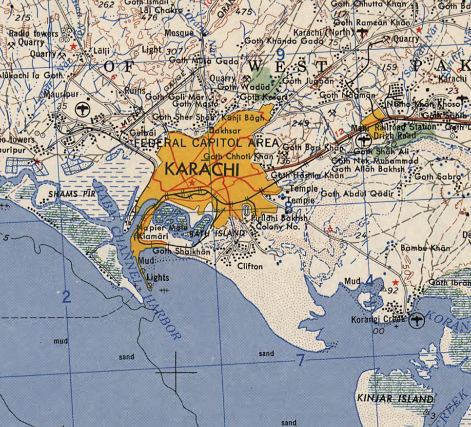
Karachi served as the capital of Pakistan until 1960, when the seat of national government moved to Islamabad. The Pakistani government believed the relocation of the capital would help spur development in the northern parts of the country. The map detail below, from a 1959 Army Map Service depiction, scaled at 1:250,000, shows the Karachi region in its final year as the national capital. Since this time, Karachi’s population has boomed from about 2 million people in 1961 (in Karachi proper) to almost 15 million people today.
_______________
Courtesy: Library of Congress Blogs (Posted on April 19, 2018)