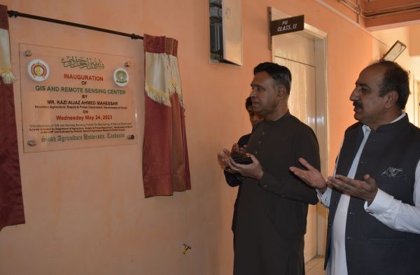
Geographical Information System and Remote Sensing Center established at Sindh Agriculture University
The Center will help forecast agricultural, climatic, irrigation, and soil conditions in the country in general and Sindh in particular
The university will offer GIS systems and remote sensing courses to undergraduate and postgraduate students
Tandojam, Sindh
Sindh Agriculture University and the Department of Agriculture of Sindh have established a modern Geographical Information System (GIS) and Remote Sensing Center in the Faculty of Agricultural Engineering of the University for forecasting of the agricultural, climatic, irrigation, and soil conditions in the country in general and Sindh province in particular.
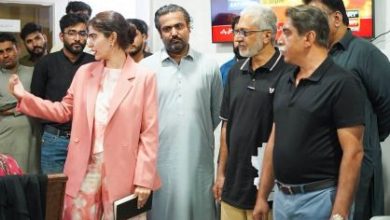
The Center was inaugurated on Wednesday by Vice Chancellor Dr. Fateh Marri, Provincial Secretary Agriculture Qazi Aijaz Mahesar and Faculty Dean Dr. Altaf Ali Siyal.
Addressing the opening ceremony, Vice Chancellor Dr. Fateh Marri said that our geographic data in the country is at HEC Islamabad only, while the sub-database unit is established at NED University Karachi, so establishing a data center at the university level is in dire need.
He said that this GIS laboratory will benefit the agricultural sector of the Sindh government, agricultural researchers, and university students. “A team, trained in this technology, will be available here. The relevant institutions and meteorologists of the country and especially of Sindh can predict disasters and droughts, while a database center will also be set up in the university.”
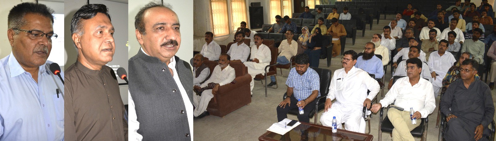 He said that there is still a lot of scope in the field of research, so modern agriculture has to be promoted to increase production per acre. In this context, agricultural institutions including the Sindh government should work together on modern projects.
Provincial Secretary of Agriculture Qazi Aijz Mahesar said that during the recent floods and rains, we faced difficulties in providing information on agricultural and other losses to national and international organizations because we did not have data validated by modern methods. He added that the establishment of GIS laboratory and database center will enable modern methods of crop reporting and monitoring of agriculture and climate conditions.
Dean Faculty of Agricultural Engineering, Dr. Altaf Ali Siyal, while giving a briefing, said that after the establishment of this center with the cooperation of the Department of Agriculture Sindh, agricultural research will be promoted by the use of geographical instruments, and the monitoring of natural resources and the use of GIS and remote sensing for mapping will enhance the capacity of faculty members, students, officials of the Department of Agriculture, technical staff of various government agencies.
He said after the establishment of this GIS lab, the university will offer GIS systems and remote sensing courses to undergraduate and postgraduate students.
Director General Agriculture Research Sindh Noor Muhammad Baloch, Dean Dr. Aijaz Ali Khooharo, Dean Dr. Syed Ghiyasuddin Shah Rashidi, Dean Dr. Manzoor Ali Abro, Dr. Farman Chandio, Dr. Irfan Shaikh and a large number of teachers and students were present. (PR)
_______________