Turning an ancient waterway into a modern corridor of transport, agriculture, tourism and flood management
By: Ramesh Raja
Sindh’s history, economy and civilization have always been inseparably linked with water. Among its most remarkable watercourses is the Nara, whose origins go far beyond the modern irrigation system. The historical Nara was essentially a natural flood and inundation channel connected with the ancient Hakra river system. During periods of high Indus floods, surplus water moved southward through this natural depression towards the Dhoro Puran and ultimately the Kori Creek and Rann of Kutch. Historical records describe the Nara as a floodwater channel rather than an originally engineered perennial canal. During the nineteenth century, British engineers progressively transformed it into an irrigation waterway by providing a controlled connection with the Indus near Rohri. With the development of Sukkur Barrage in 1932, the Nara became one of the principal perennial canals of Sindh. The modern Nara is therefore the product of a remarkable transformation from natural flood channel to major irrigation artery. The historical Nara-Puran corridor, extending southward towards the Rann, offers an extraordinary foundation for a new regional development vision.
From Sukkur to the Rann
Today, the Government of Sindh Irrigation Department records the Nara Canal at approximately 364 kilometers, with a designed discharge of around 13,649 cusecs and a gross command area exceeding 2.2 million acres. Its extensive network of branches, distributaries and minors supports agriculture across a large part of Sindh. Historically, however, the Nara waterway continued considerably farther south. Historical irrigation records have placed the old Nara course at approximately 560 kilometers from Rohri towards the Rann of Kutch, through the Dhoro Puran system. For a modern planning concept, therefore, a Sukkur-to-Rann corridor of roughly 500–560 kilometers could be studied, although the 560-kilometre figure should be regarded as a tentative development-corridor estimate rather than a formally surveyed historical canal length. The proposal would follow the broader historical Nara-Puran geographical corridor while connecting with the present Nara Canal and its irrigation network.
The Nara Express Highway
The proposed Nara Express Highway could become a new north-south transportation and economic spine for Sindh. The concept would involve developing a modern highway broadly along both banks of the Nara system wherever technically, hydraulically and environmentally feasible. It would not necessarily remain immediately beside the canal throughout its entire length; alignment would be determined through detailed surveys of canal right-of-way, settlements, flood levels, wetlands, agricultural land and environmental constraints. The corridor could connect the Sukkur and Khairpur region with Gambat and other Upper Sindh settlements, then extend towards Sanghar, Khipro, Umerkot, Mirpurkhas and the southern Nara landscape, with carefully planned connections towards Tharparkar and the Rann. Strategically designed interchanges and feeder roads could integrate surrounding towns and villages. The highway would provide an alternative north-south route to existing highways, particularly N-5, improving traffic distribution, reducing pressure on congested routes and providing greater resilience during floods, accidents and other disruptions.
Agriculture, Industry and Rural Economy
The strongest economic justification for the project would be agriculture. The Nara irrigation command supports millions of acres, yet agricultural prosperity depends equally upon efficient transportation, storage, processing and access to markets. The proposed highway could therefore be developed with a chain of agricultural logistics centers containing collection yards, grading and packaging facilities, cold storage, warehouses, truck terminals, livestock markets and food-processing units. Khairpur could be strengthened as a major date-processing and export center, while Sanghar and surrounding areas could support cotton, wheat, sugarcane, chillies and other crops. Mirpurkhas could benefit from improved mango and horticulture logistics, while Umerkot and Tharparkar could develop livestock, dairy, vegetables and desert products. Designated industrial and energy zones could also connect the corridor with Sindh’s gas-producing areas and renewable-energy potential. The highway would thus become a farm-to-market and market-to-industry connection, creating employment and reducing transport losses.
Water, Wildlife and Tourism
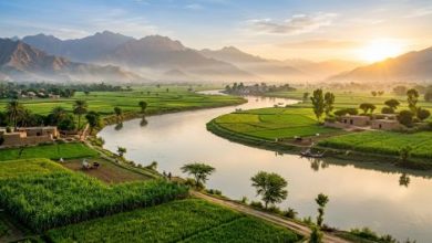
The Nara corridor could become one of Pakistan’s most distinctive scenic routes, combining flowing water, green agricultural fields, date plantations, wetlands, sand dunes, desert landscapes and rural Sindhi culture. Riverside parks, viewing platforms, family picnic areas, rest areas, walking and cycling tracks and cultural centers could be developed at carefully selected locations without interfering with irrigation operations. The ecological dimension could be equally important. Existing wetlands and wildlife habitats could support controlled eco-tourism, bird-watching and fisheries development. Where scientifically confirmed crocodile habitats exist, protected crocodile conservation and viewing centers could become unique attractions rather than sites of uncontrolled interaction. The historical relationship between the Nara and the Rann also provides an opportunity to examine modern flood-management measures. Detention basins, restored wetlands, controlled drainage channels and flood-storage areas could potentially provide additional protection during exceptional floods while supporting groundwater recharge and biodiversity. Such measures must, however, be based on detailed hydrological and environmental studies.
A New Vision for Sindh
The Nara Express Highway should not be conceived simply as another road project. It should be planned as a Nara Economic, Agricultural, Tourism and Ecological Development Corridor, bringing together transport infrastructure, agriculture, industry, tourism, and wildlife and water management. Its network could include modern carriageways, service roads, bridges, agricultural logistics parks, cold-storage facilities, tourism centers, riverside parks, fisheries facilities, wildlife conservation areas, truck terminals, emergency services, EV charging stations and renewable-energy zones. Such a corridor could connect communities that remain economically distant from major markets and create a new tourism circuit from Sukkur and Rohri through Khairpur, the Nara wetlands, Sanghar, Khipro and Umerkot towards Thar and the Rann landscape. The idea deserves a comprehensive feasibility study by the Government of Sindh in coordination with the Irrigation Department, NHA, Planning and Development Department, Environment, Wildlife and Tourism authorities. The Nara once carried surplus waters of the Indus towards the Rann. A modern Nara corridor could carry something equally valuable in the twenty-first century: people, agricultural produce, investment, tourism and opportunity. It could transform an ancient waterway into a new economic spine for Sindh while preserving the history, ecology and landscapes that make the Nara unique.
Read: Past Wars Still Cost the Earth
_________________
 The author of this article, Engr. Ramesh Raja, is a Civil Engineer, visionary planner, PMP certified and literary enthusiast with a passion for art and recreation. He can be reached at engineer.raja@gmail.com