Where History Flows Through Ancient Sands
Gambat: A History Written By Kalhoras, Sufis, Rivers And Time

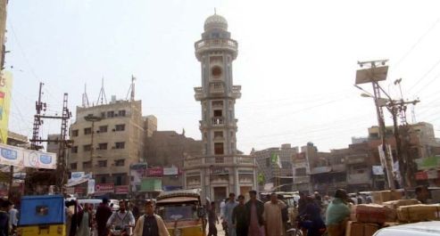
A journey from the ancient landscape of Upper Sindh to the historic town shaped by the Kalhoras, Talpurs, Pirs, canals and the railway
By: Ramesh Raja
My city, Gambat, is the oldest urban center of Gambat Taluka; according to the 2023 Census, Gambat Taluka has a total population of 286,129, comprising 104,353 urban and 181,776 rural residents. The Taluka covers 582 km², with a population density of approximately 492 persons per km².
Within the Taluka, Gambat Municipal Committee (Gambat City) has a population of 59,790, comprising 30,018 males, 29,758 females and 14 transgender persons, according to the 2023 Census.
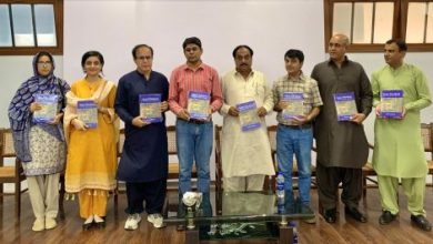
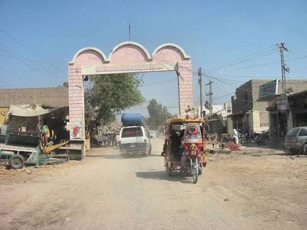 We, friends in the literary circles of Gambat, have always remained curious and anxious to discover the true history of our city. Despite our efforts, we could not fully trace its historical journey with certainty. What I have been able to find so far is therefore placed before you all as an interim historical account, prepared from available books, historical records, reports and gazetteers.
It is not a final history of Gambat, nor does it claim to answer every question about its origin, name, people and development. Rather, it is a beginning, based on whatever documentary evidence could be traced. I hope it will encourage historians, researchers, writers and the people of Gambat to examine the references further, correct what may be incomplete, and add what has remained undiscovered. This is not the end of the search for Gambat’s history. It is simply a start.
The historical form of the name appears in sources as “Gambaz or Gambat”, while the Kalhora tradition refers to “Khambat Pargana” in connection with Channey Khan and the Khuhra-Gambat area. The exact linguistic relationship between Khambat, Gambaz, Gumbat and modern Gambat has not yet been conclusively established, so it should not be confidently attributed either to a Hindu origin or to gumbad/gumbaz without further primary-source evidence. Reference: N. M. Billimoria, Journal of the Sindh Historical Society, Vol. VI, No. 4, 1943, p. 345; Rabia Khaskheli & Mazhar Hussain Abbasi, 2024, p. 64.
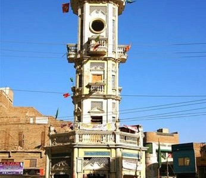 By 1876, Gambat was an established town of Khairpur State. Hughes described it as “a somewhat large town in the Khairpur State”, recording about 3,000 inhabitants in 1844 and 4,537 in 1876, besides noting its cotton industry. Reference: A. W. Hughes, A Gazetteer of the Province of Sind, 2nd ed., 1876, p. 170.
By 1935, Gambat was definitely a Taluka of Khairpur State, with a population of 69,610; its principal towns included Gambat, Khuhra, Ranipur and Hingorja. Reference: M. B. Pithawalla, A Geographical Analysis of Khairpur State, 1935, p. 35. The exact year of its creation as a Taluka has not yet been established.
For the wider Khairpur State, Pithawalla recorded 227,183 people: 186,577 Muslims (83%), 39,894 Hindus (17%) and 712 others. He identifies Sumras and Sammas among the principal Sindhi Muslim groups and Rinds, Muris, Chandias and Jatois among Baloch communities. Among Hindus, he specifically identifies Lohanas and Banias as major trading communities and states that they preferred towns including “Gambat, Ranipur, Khairpur”; he also mentions Soda Thakurs and Rajputs. Reference: Pithawalla, 1935, pp. 33–34. These are State-wide figures, not a separate census of Gambat town.

Gambat: A Historical Note from the Kalhora Era to the Modern Town
The history of Gambat should be reconstructed primarily from the Kalhora, Khairpur State and British-era records, because these provide the clearest documentary trail for the town. There is presently no conclusive archaeological or documentary proof that the present Gambat was an urban settlement during the Indus Valley Civilization or in the time of Raja Dahir. The wider Khairpur region is unquestionably ancient, with important prehistoric and Indus-period sites such as Kot Diji and Kathor, but those discoveries should not be automatically attributed to Gambat itself.
The earliest strong lead for Gambat’s documented history comes from the Kalhora genealogical tradition, particularly the connection of Mian Channey Khan with Khambat Pargana and the tomb associated with him at Khuhra, immediately north of Gambat. Rabia Khaskheli and Mazhar Hussain Abbasi, in The Kalhora Dynasty: A Period of Islamic Architecture, From the Early Throne to the Present (2024), write that Channey Khan “relocated to Khambat Pargana” and lived there with the Odheja tribe until his death. The authors further state: “The Channey Khan tomb is located in Khuhra village, which is north of Gambat town in Khairpur. Gambat town is well-known for the tomb of Mian Channey Faqir.” They also state that Channey Khan founded Jhangara-Bajara about 1220 AD, although that statement refers to Jhangara-Bajara, not to the founding of Gambat. Reference: Rabia Khaskheli & Mazhar Hussain Abbasi, “The Kalhora Dynasty: A Period of Islamic Architecture, From the Early Throne to the Present,” Sir Syed University Research Journal of Engineering & Technology, Vol. 14, No. 2, 2024, pp. 63–72, especially p. 64.
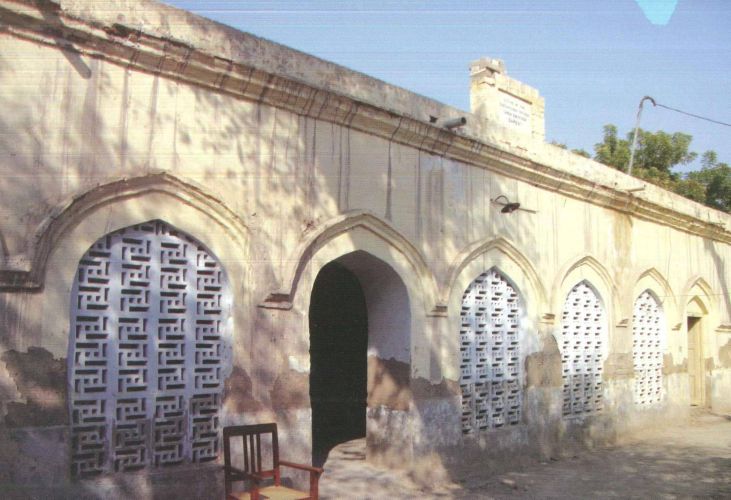
This evidence is important because it gives us a possible medieval geographical connection between Khambat and the Gambat-Khuhra area, but it would be premature to declare that Khambat was definitely the original name of present-day Gambat. That question requires examination of the original Persian chronicles and manuscripts. Nevertheless, the Kalhora connection provides a much stronger historical starting point than the unsupported claim that Gambat was founded by the British or suddenly appeared in the nineteenth century.
The Kalhora political period, conventionally dated 1701–1783, gives Gambat a much clearer historical setting. Mian Yar Muhammad Kalhoro emerged as the principal Kalhora political leader at the beginning of the eighteenth century; Mian Noor Muhammad ruled from 1737 to 1755, Mian Ghulam Shah from 1757 to 1772, Mian Sarfaraz from 1772 to 1775, and Mian Abdul Nabi from 1775 to 1783. The Kalhora dynasty ended after the Battle of Halani in 1783. The 2024 Kalhora study records that Mian Naseer Muhammad died in 1692, Mian Din Muhammad in 1700, Mian Yar Muhammad in 1718, Mian Noor Muhammad in 1753, and Mian Ghulam Shah in 1772, while Kalhora political rule continued until 1783. Reference: Khaskheli & Abbasi, 2024, pp. 64–66.
Gambat’s religious history is inseparable from Khuhra. The Jillani family tradition records that Syed Muhammad Shah Jillani Baghdadi and his brother Syed Ahmed Shah Jillani Baghdadi came from Baghdad and stayed with Makhdoom Ahmadi of Khuhra. The heritage record states that Makhdoom Ahmadi subsequently permitted them to establish religious institutions at Ranipur and Gambat. It records that the Gambat branch became associated with Syed Muhammad Shah. A local historical account associated with the tomb gives his arrival in Sindh as 1189 AH, but this date should be treated as a traditional genealogical date rather than an independently established modern historical date. His death is given as 14 Rabi-ul-Awwal 1210 AH, corresponding to 28 September 1795 CE, at Gambat. Thus the late eighteenth century was a decisive period in Gambat’s development as a Sufi center, but the Jillanis should be regarded as an important religious establishment within an existing settlement, not as the founders of Gambat itself.
 The neighboring Daraza provides another important cultural connection. Sachal Sarmast was born in 1739 at Daraza, near Ranipur, and died in the nineteenth century. A biographical study places Daraza “between Gambat and Ranipur Railway station,” demonstrating the close geographical relationship between these settlements. Reference: “Sachal,” biographical study, reproduced by Dr. Pathan, p. 1. Sachal therefore belongs to the same wider religious and cultural landscape that included Khuhra, Gambat and Ranipur. His lifetime, 1739–1827/1829 depending on the source, overlapped the last decades of Kalhora rule and the early Talpur period.
The next major political transformation came in 1783, when the Talpurs established the Khairpur State under Mir Sohrab Khan Talpur. Pithawalla’s 1935 historical study gives a valuable contemporary account. He writes that Chakur was the father of Sohrab, “the founder of the Khyrpoor State,” and records that “At length in 1783 A.D.” the Talpur political settlement was established. He further states that Sohrab went to Khairpur and “declared himself Ameer of the adjacent districts.” Reference: M. B. Pithawalla, A Geographical Analysis (Including Physiography) of Khairpur State: A Post-Barrage Investigation, Haroon Press, Karachi, 1935, pp. 2–3.
Gambat subsequently became one of the important settlements of this princely state. By 1935, Pithawalla explicitly lists Gambat as one of the five Talukas of Khairpur State, alongside Khairpur, Mirwah, Faiz Ganj and Nara. He gives the population of Gambat Taluka as 69,610 and identifies Gambat, Khuhra, Ranipur and Hingorja among its important towns. Reference: Pithawalla, 1935, p. 35. This is firm documentary evidence that Gambat was a Taluka by 1935. It does not yet establish the precise year when the Taluka was created, so the family tradition that it was already a Taluka before 1900 requires further archival verification.
Pithawalla provides an exceptionally valuable description of Gambat’s social and commercial character. He writes: “Gambat and Ranipur. These are the chief Hindu centers of trade where fairs are held every year.” Reference: Pithawalla, 1935, p. 37. He also records that Hindus in Khairpur State were principally Lohanas and Banias, engaged in trade, and that they preferred towns such as “Gambat, Ranipur, Khairpur.” The principal Muslim population was described as predominantly Sindhi, including Sumra and Samma groups, while Baloch tribes included Rind, Muri, Chandia and Jatoi. Reference: Pithawalla, 1935, pp. 33–34. Therefore, for the historically documented pre-Partition social structure, Lohanas and Banias were among the principal Hindu trading communities of Gambat, while the wider Muslim population included Sindhi groups such as Sumra and Samma and various Baloch tribes. Later Gambat records also preserve distinct Memon, Shaikh and Hindu mohallas, but these should not automatically be described as the town’s “original” castes without earlier census evidence.
The British period transformed Gambat’s communications and economy without creating the town itself. The 1876 Gazetteer of the Province of Sind describes Gambat as an established town of Khairpur State and records a population of about 4,537, compared with approximately 3,000 in 1844. Hughes also records Gambat’s importance in cotton manufacture. Reference: A. W. Hughes, A Gazetteer of the Province of Sind, 2nd ed., 1876, p. 170. This is decisive evidence against the idea that Gambat was a British-founded town.
The railway further strengthened Gambat’s position. The Karachi–Rohri railway system developed during the nineteenth century, with the Kotri–Rohri section completed in 1900; Gambat lies on the historic Karachi–Peshawar railway alignment between Ranipur and Khairpur. The Gambat station subsequently became an important transport and trading point. The heritage record describes it as an important source of transportation and communication and notes that passenger and freight trains increased trade activity in Gambat and surrounding areas.
 Another decisive transformation came with the Sukkur Barrage, sanctioned in 1923 and made operational on 13 January 1932. The Sindh Irrigation Department records that the barrage’s left-bank canals included the Rohri Canal, East and West Khairpur Feeders and Nara Canal. Pithawalla records that the Khairpur State eventually joined the barrage system because the Rohri Canal had to pass through state territory. He writes that the Rohri Canal “had to be cut through the State territory” and records its completion in the barrage system in 1932. Reference: Pithawalla, 1935, pp. 12–13.
The older irrigation landscape is equally significant. Before the barrage, the Khairpur area was served by old inundation canals, including Mir Wah, Nara Wah, Abul Wah, Main Wah and Sanhro Wah. H. M. Dahar records that Abul Wah was 28 miles long and 60 feet wide at its head. Reference: H. M. Dahar, Sindh Irrigation Engineering: History, Theory and Practice, §3.12.2, p. 36. The transition from these seasonal systems to the perennial Sukkur Barrage canals fundamentally changed agriculture around Gambat.
Thus Gambat’s documented story is best understood as a Kalhora-era settlement associated with the Khambat-Khuhra landscape, transformed into an important Sufi and trading center during the Talpur Khairpur State, and subsequently expanded through British-era railway and twentieth-century barrage irrigation. The evidence firmly establishes Gambat as an old pre-British town; it does not yet prove an Indus Valley or Raja Dahir-era urban settlement at the present site. The unresolved Khambat–Gambat identification remains perhaps the most important subject for further research into Gambat’s earliest history.
Principal references:
- W. Hughes, A Gazetteer of the Province of Sind, 2nd ed., George Bell & Sons, London, 1876, p. 170. Gambat’s location, status, population and cotton industry.
Hughes, *A Gazetteer of the Province of Sind* (1876)
- N. M. Billimoria, “Prof. Hodiwala’s Comments on Tarikh-i-Masumi,” Journal of the Sindh Historical Society, Vol. VI, No. 4, 1943, pp. 329–349, relevant note p. 345. “Gambaz or Gambat” and location.
*Journal of the Sindh Historical Society*, Vol. VI, No. 4 (1943)
- M. B. Pithawalla, A Geographical Analysis (Including Physiography) of Khairpur State: A Post Barrage Investigation, Haroon Press, Karachi, 1935, p. 45. Gambat as a taluka, population 69,610, important towns.
Pithawalla, *A Geographical Analysis of Khairpur State*
- Rabia Khaskheli & Mazhar Hussain Abbasi, “The Kalhora Dynasty: A Period of Islamic Architecture, From the Early Throne to the Present,” Sir Syed University Research Journal of Engineering & Technology, Vol. 14, No. 2, 2024, pp. 63–72, especially p. 64. Channey Khan, Khambat Pargana and tomb at Khuhra/Gambat.
- H. M. Dahar, Sindh Irrigation Engineering: History, Theory and Practice, Chapter 8, p. 72 onward. Pre-1869 zamindari bunds, 1869 Sukkur-Begari Bund, 1874 flood, Kashmore Bund and development of the later flood-protection system.
*Sindh Irrigation Engineering: History, Theory and Practice*
- Directorate of Archaeology & Museums, Government of Pakistan, “Kathor 2.” Protohistoric settlement, approximately 3500–1800 BCE; source cited as Ancient Pakistan, Vol. XV, 2002.
- Directorate of Archaeology & Museums, Government of Pakistan, “Kathor 5.” Prehistoric settlement, tentatively 18,000–8,000 BCE; possible Mesolithic-to-Mature-Indus occupation.
- Government of Sindh, Directorate General of Antiquities, Kot Diji archaeological site. Pre-Harappan/Kot Dijian cultural sequence and archaeological importance.
- M. R. Haig, The Indus Delta Country: A Memoir, Chiefly on Its Ancient Geography and History, Kegan Paul, Trench, Trübner & Co., London, 1894, 148 pp. Essential primary historical-geographical source, particularly for ancient Sindh and changing river geography. I have not found a verified passage in the original text that says Haig dated the founding of Gambat to 1200 CE.
Haig, *The Indus Delta Country* (1894)
- Mir Ali Sher Qani, Tuhfat-ul-Kiram, completed 1767–68 CE; later Sindhi Adabi Board edition. One of the essential primary sources for medieval and early-modern Sindh; the third volume deals specifically with Sindh, its rulers, saints and scholars.
Read: From the Bypass to the Blueways
_________________
 Engr. Ramesh Raja is a civil engineer and managerial/ planning professional who also contributes as a freelance writer on technical matters. He may be reached at engineer.raja@gmail.com