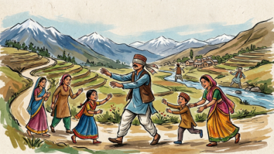
Military geography serves as the vital intersection where physical science, statecraft, and armed conflict converge to shape national security.
By analyzing the natural and human landscape, it equips strategists with the spatial context required to secure operational advantages and avoid catastrophic failure.
Noor Muhammed Marri, Advocate | Islamabad
Military geography has always struck me as the vital intersection where physical science, statecraft, and the demanding art of armed conflict meet. When I examine this interdisciplinary branch of geography and military science, I see a discipline that looks at physical, cultural, and political landscapes through the rigorous lens of national security, grand strategy, and tactical combat operations. At its core, military geography analyzes how environmental elements—such as rugged terrain, volatile climate, intricate hydrography, dense vegetation, and vital human infrastructure—fundamentally influence military planning, logistical execution, maneuverability, and the ultimate outcomes of military campaigns. By bridging the gap between natural environments and human activity, it provides commanders, strategists, and analysts with the precise spatial context required to secure operational advantages and avoid catastrophic miscalculations in the theater of war.
 Throughout history, I have observed how the configuration of the earth serves as both the stage and an active participant in warfare. From ancient mountain passes that allowed outnumbered defenders to hold off mighty empires, to vast arid plains that dictated the operational range of mechanized cavalry and modern armored divisions, terrain has consistently imposed absolute limits on human ambition. Military geography systematizes these observations. It evaluates the relief, slope, and trafficability of landscapes, translating contour lines and soil compositions into tactical realities. It assesses how rivers act as natural moats or logistical bottlenecks, how dense forests obscure troop movements while fragmenting communications, and how extreme weather conditions can reduce the most advanced technological military apparatus to a standstill. Understanding these variables allows military planners to anticipate friction points, design viable supply lines, and exploit environmental asymmetries to achieve victory.
In my exploration of the academic and professional literature dedicated to this field, several seminal works and authors stand out for shaping our understanding of how space and power interact. John M. Collins established a premier benchmark with Military Geography for Professionals and the Public, offering a comprehensive, systematic framework for evaluating how physical geography dictates strategic success. Similarly, Eugene J. Palka and Francis A. Galgano edited Military Geography: From Peace to War, creating an essential textbook for modern military academies that bridges micro-terrain analysis with grand strategy. Francis A. Galgano further modernized the field in Modern Military Geography, integrating contemporary technologies like Geographic Information Systems and geospatial intelligence into traditional spatial studies. Other critical contributions include Harold A. Winters, Gerald A. Galloway, Jr., and William J. Reynolds’s Battling the Elements: Weather and Terrain in the Conduct of War, which examines how environmental hazards directly alter historical campaign trajectories; Patrick O’Sullivan’s Terrain and Tactics, which explores the micro-level geometry of combat; and Sir Halford J. Mackinder’s foundational geopolitical text, Democratic Ideals and Reality, which links geographic heartlands to global dominance.
To my mind, the importance of military geography to state survival and operational success rests on several distinct pillars. First, it is indispensable for operational planning and execution. Understanding relief, slope, and trafficability allows military commanders to determine optimal routes for troop deployments, heavy mechanized forces, and supply convoys, ensuring that armies do not bog down in impassable terrain or expose themselves to predictable bottlenecks. Second, it provides a decisive tactical advantage. Comprehensive knowledge of micro-terrain, natural cover, concealment, and lines of sight directly dictates defensive positioning, ambush placement, and the precise execution of offensive maneuvers. Third, geography dictates logistics and sustainability. An army marches on its stomach, and the geographic reality of lines of communication, the viability of supply chains, and the availability of local sustenance or water resources dictate how far a force can project power before culminating. Finally, military geography offers vital strategic foresight. It helps nations assess their geopolitical vulnerabilities, establish natural buffer zones, secure maritime chokepoints, and identify potential avenues of foreign aggression long before a shot is fired.
Among the literature dedicated to this field, one text stands out to me as universally acclaimed and widely read across international military academies and professional development courses: Military Geography: From Peace to War, edited by Eugene J. Palka and Francis A. Galgano. This comprehensive volume is structured to guide readers systematically from the theoretical underpinnings of environmental analysis to its complex practical applications in modern warfare. The core premise of the book establishes that geography is never a passive, static backdrop to conflict; rather, it is an active, dynamic participant that shapes strategy at every single level of war—strategic, operational, and tactical. The authors and contributing scholars dissect the spatial dimensions of conflict, demonstrating how absolute distance, relative distance, scale, and regional characteristics dictate force projection and define the ultimate limits of military power.
Furthermore, Military Geography: From Peace to War provides exhaustive examinations of physical environmental factors, detailing how extreme weather phenomena, diverse topography ranging from towering mountain ranges and arid deserts to dense jungles and sprawling urban environments, and complex hydrology constrain or enable both military technology and personnel. The text seamlessly integrates human and political geography, illustrating how cultural landscapes, intricate infrastructure networks, population distributions, and arbitrary political boundaries must be factored into every operational calculation. Crucially, the book addresses technological integration, explaining how modern tools such as Geographic Information Systems, remote sensing, and advanced geospatial intelligence have revolutionized terrain analysis, empowering contemporary commanders with unprecedented real-time spatial awareness on the modern digital battlefield. Ultimately, I believe the volume reinforces the timeless lesson that ignoring geographical realities invariably leads to strategic failure, cementing environmental literacy as an absolute prerequisite for effective military leadership and national defense policy.
Read: Guarding the Supreme Law of Democracy
_____________
 Noor Muhammad, Advocate and Mediator, Islamabad